Trekking in the Grecanic Aspromonte
Gallicianò · Grecanic Area

Gallicianò Trails
nature, village and Amendolea

Real GPX tracks, KML for Google, local map with GPS position and clear instructions: the trail must now serve while a person walks, not act as digital decoration.

Explore the Territory

Real, clear, downloadable trails

Here you don’t need buttons placed for decoration: every trail has a start on Maps, a downloadable track, a safety note, and a readable map. The goal is to truly help the guest prepare, without pretending these are official or guided excursions.

Important note on the trails. The tracks are real GPX provided by users and reworked into lightweight GPX/KML/GeoJSON versions. They serve to orient yourself, prepare the visit, and follow your own point on the local map. They do not replace signage, caution, weather, physical conditions, on-site checks, or updated information. Google Maps is useful for reaching the start/finish; the precise track must be followed via GPX/KML or the local map.
Note: In case of orientation problems or signal loss, we highly recommend consulting the Wikiloc app to find local tracks of Gallicianò.
Easy 30-45 min · 1.3 km

Gallicianò village tour

Short walk inside the village: alleys, viewpoints, Fountain of Love, cultural sites, and first orientation for those arriving at Casa Giufà.

  • Start: Center of Gallicianò
  • Finish: Center of Gallicianò
  • GPS Elevation: +21 m / -18 m
  • File origin: Wikiloc - Gallicianò

Correct use: Perfect for newly arrived guests. It’s not a technical trek: it helps read the village without getting lost in the alleys.

Hiking About 1h45-2h15 · 5.4 km

PNA 128 Trail · Gallicianò / Bova

Cleanest and most useful track to narrate the hiking connection between Gallicianò and the Bova area, without inflating promises like an improvised tourist agency.

  • Start: Gallicianò
  • Finish: Direction Bova / PNA 128 track
  • GPS Elevation: +336 m / -311 m
  • File origin: Wikiloc - PNA 128 Trail Bova Gallicianò

Correct use: It is the trail to highlight for those who want a serious but manageable walk. The final point must be verified with the real track and trail conditions.

Medium/Challenging About 3h30-5h · 11.9 km

Gallicianò / Bova · long Wikiloc variant

Longer variant towards Bova. Interesting for motivated hikers, not for those who want to take two photos and then complain about the sun.

  • Start: Gallicianò
  • Finish: Bova
  • GPS Elevation: +160 m / -143 m
  • File origin: Wikiloc - Gallicianò - Bova

Correct use: To be proposed as a real hiking trail, not as a walk for everyone. The return must be checked.

Hiking About 2h30-3h30 · 7.7 km

Gallicianò / Amendolea

Descent towards Amendolea and its fiumara: it is one of the most useful connections to narrate the Aspromonte and Grecanic part of the experience.

  • Start: Gallicianò
  • Finish: Amendolea
  • GPS Elevation: +20 m / -66 m
  • File origin: Wikiloc - Gallicianò - Amendolea

Correct use: Beautiful trail but to be verified with weather, terrain, and crossings. It should not be sold as a guided service.

Hiking/Challenging About 3h30-5h · 9.8 km

From Gallicianò to Roghudi

Track for those who want to push towards one of the most powerful and delicate places in the Grecanic area. Beautiful, serious, not to be trivialized.

  • Start: Gallicianò
  • Finish: Roghudi
  • GPS Elevation: +58 m / -71 m
  • File origin: Wikiloc - Da Gallicianò a Roghudi

Correct use: To be presented as an option for prepared hikers. Verify accesses, conditions, signal, and return.

Very challenging Full day · 32.0 km

Gallicianò / Bova Marina

Long path towards the sea, to be kept as an advanced track. It is not a proposal for the average guest: it is material for true walkers.

  • Start: Gallicianò
  • Finish: Bova Marina
  • GPS Elevation: +170 m / -176 m
  • File origin: Wikiloc - Gallicianò - Bova Marina

Correct use: To show at the bottom, as an expert option. Requires return planning and a serious evaluation of conditions.

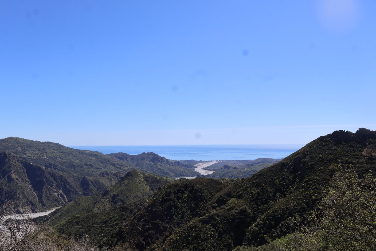
Panorama of the Grecanic Area from Gallicianò
Recommended Experience

Starting from Amici Di Gallicianò Casa Giufà

The trails are proposals for discovering the territory linked to Amici Di Gallicianò Casa Giufà. We do not communicate official tourist services: those interested contact us, then we evaluate together information, availability, trail conditions, and the most suitable methods.

  • ✦ Practical information from those who live in the territory
  • ✦ Reference point: Amici Di Gallicianò Casa Giufà
  • ✦ Grecanic culture told with respect
  • ✦ Authentic Aspromonte nature
  • ✦ Typical cuisine a few steps away with Nizio Paleò: full menu at 25 € instead of 30 € for Casa Giufà guests, subject to confirmation
  • ✦ Indications to be evaluated based on people, weather, and season
Talk to us before the visit
Trails map

Real map with GPS

Choose a trail, activate your location and the site shows you how close you are to the track. Works best on mobile, with authorized GPS and connection. For serious offline use, it is better to import the GPX into Wikiloc or a hiking app.

Preparation

Advice before leaving

To best experience the trails we recommend suitable shoes, water, a hat on hot days, downloaded GPX before leaving, and a brief check of weather conditions. For longer stretches, it is always recommended to check with Giuseppe or Elisa.

Recommended equipment

  • • Trekking shoes with treaded soles
  • • Flask with enough water
  • • Hat and sun protection
  • • Comfortable and layered clothing

Orientation and Safety

We advise you to consult the trail description before leaving and write to Giuseppe to receive practical information. Do not leave without checking weather, water, trail terrain, and personal conditions.

Download

Guides and tracks ready for the guest

Final and understandable tools: PDF guide, online guide, dedicated map, and downloadable tracks. Everything must lead to something real.

Download the tracks before leaving and open the track files with a compatible outdoor app. Tracks help orient yourself, but do not replace real checks, weather, caution, and updated information.

Download complete PDF guide Read the online guide Open GPS map Download all GPX tracks Download KML for Google How to open tracks on Maps and GPS apps
Recommended arrival

Arrive at the parking lot, then 90-100 meters on foot

To avoid confusion inside the village, set your navigator to Parcheggio, 89030 Gallicianò RC: the first button automatically uses your current position as the start. After leaving the car, continue on foot towards Via Anaghorio, 89030 Gallicianò RC: the distance is short, about 90-100 meters. Do not drive all the way to the front of the house.

Navigation

Continue the visit without getting lost

You can go back, return to the Home, or go to the next page of the recommended path.